Latest News
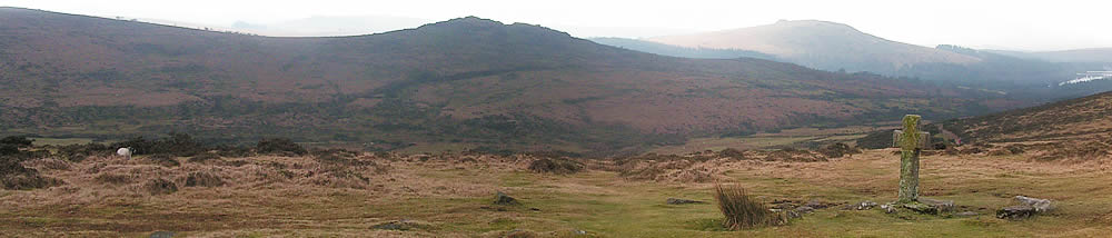
Dartmoor is an upland region of moorland in the county of Devon, in the southwest of England. It covers approximately 368 square miles, and rises to 621m (2037 ft) above sea level. Underlying the moor is Carboniferous granite, which is visible at the surface as tors - rocky outcrops at the summits of many of the hills.
The Moor was designated a National Park in 1951. Nearly 36000 hectares (88900 acres) of the Park is common land, some 37% of the Park's whole area and more than 75% of its moorland. Importantly, the commons form the heartland of Dartmoor and that vast open space which is the main reason for its National Park status.
Under the Dartmoor Commons Act (1985), the Dartmoor Commoners' Council was established to represent the commoners, make regulations about most matters, which concern the management of the commons and the welfare of the stock de-pastured on the commons, and to enforce the Dartmoor Commoners' Council Regulations.
Zero Tolerance Policy
Our Council Members
and support staff have the right to be treated with dignity and respect at all
times. They should be able to carry out
their duties and do their jobs without being physically, mentally or verbally
abused and this behaviour will not be tolerated.
Privacy Policy
Your privacy is important to us and we take our responsibility regarding the security of your personal information very seriously. To reflect the newest changes in data protection law, and our commitment to transparency, we have produced a Privacy Statement. If you'd like to find out more, take a look at our Privacy Policy.
Sick & Injured Animals on Dartmoor
Contact Livestock Protection Officer Karla McKechnie on 07873 587561
Road Traffic Incidents Involving More...
Dartmoor Commoners' Council, 1 Canal Road, Tavistock, Devon, PL19 8AR Tel: 01822 618892
Terms of Use Accessibility Statement (w) (c) Last updated 28th May 2025 Mobile Website by WesternWeb Ltd